Shifting Coastal and River Shores: The Power of Erosion
Please note that our Stroy Maps are best viewed on a tablet in landscape mode, laptop, or PC screen!
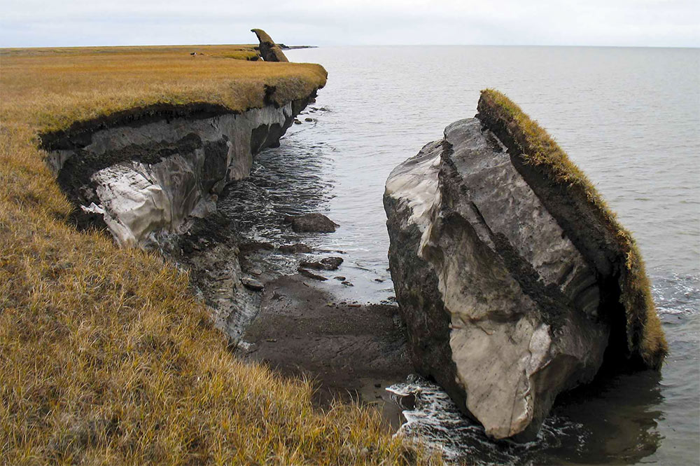
Permafrost coasts can recede at an alarming rate of over 20 meters in just 4 months, where the Arctic Ocean is ice-free. ? Thawing permafrost makes Arctic coastlines especially vulnerable to erosion, often leading to rapid shoreline retreat. Erosion occurs through various processes, and global warming is intensifying several of the environmental factors driving these changes. Shore erosion affects many water bodies across the Arctic, including lakes, rivers, and coasts. These different environments are influenced by different factors, which in turn determine when and where the most significant erosion occurs.
In this story map, you'll find key facts about annual erosion rates, their spatial distribution across the Arctic, and how these dynamics may develop in the future.
Relevance of shore erosion
Coastal erosion impacts large portions of the Arctic coastline, where permafrost deposits are unconsolidated but still frozen, while river erosion follows similar patterns along the expansive river networks of the region. These landscape changes threaten ecosystems, wildlife habitats, infrastructure, and subsistence activities. ? On a global scale, permafrost erosion plays a role in releasing ancient, frozen carbon from the permafrost, which leads to the emission of additional greenhouse gases into the atmosphere.
Shore erosion in the change map

In the change map, shore erosion is typically represented in dark blue, indicating an increase in wetness over time.
You can choose to display only the wetness layer (in either dark or light mode) by selecting the »change visualization type«
drop-down menu in the top right corner of the map. Alternatively, click the buttons below:
