Story Map »Thermokarst Lakes«: Slide 3
Lake Growth
Thermokarst lakes continue to grow their surface area over time, as shown in Figure 2. This process is still occurring in all regions where lakes are formed in sediments bound by permafrost.
Several erosional processes occur along the shoreline (Grosse et al., 2013). These include a) the development of thermo-erosional niches, b) thaw slumping and block failure, c) mechanical erosion caused by ice shoving during breakup, and d) the incorporation of polygonal ponds into the lake.
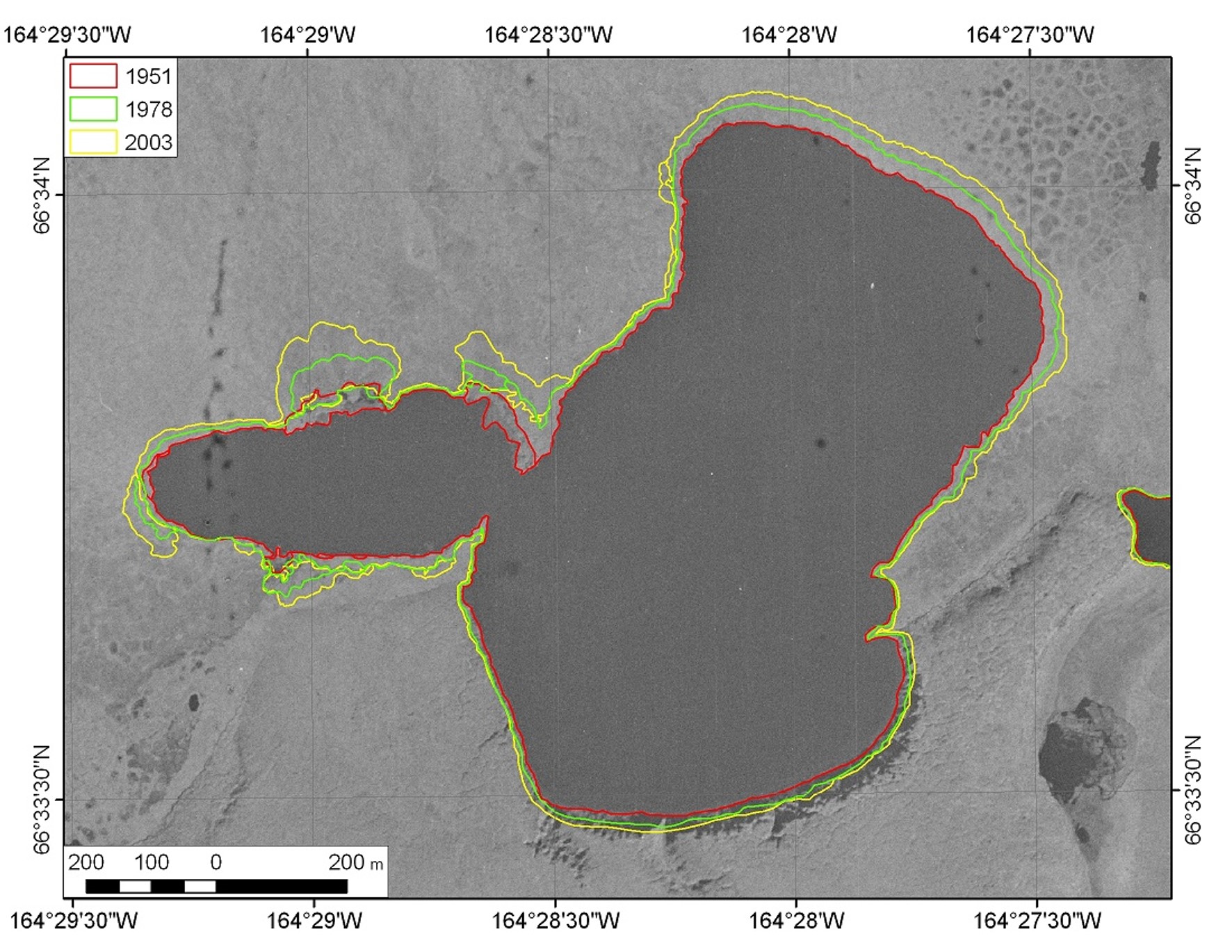
A study of lake dynamics in areas of eastern Canada, Alaska, and eastern and western Siberia found that lake growth increased toward regions with continuous permafrost, but was present in all areas (Nitze et al., 2018). A more local study from the Seward Peninsula in Northwest Alaska determined the shore line shift of thermokarst lakes (Jones et al., 2011). Between 1950/51 and 1978, the nearly 700 surveyed lakes on average expanded by 0.34 m per year and between 1978 and 2006/07 by 0.39 m per year. Figure 4 shows an example of a growing lake and its changing shoreline positions between 1951, 1978, and 2003 from Lake Rhonda on the Seward Peninsula.

Figure 4: Lake Rhonda shore line map (source: see last slide).
The map of Lake Rhonda shows the location of the shoreline for the years 1951 (red), 1978 (green), and 2003 (yellow) with a black and white aerial image from 1951 as background. Reduce the opacity to see a more recent situation on the remotely sensed images.

Use the baselayer switcher at the bottom right of the map to change the background (see screenshot). If you choose to display the change map, you can see that the northern shore of Lake Rhonda has continued to erode over the past 20 years (blue colors), while sediment has been deposited on the southern shore of the lake (yellow colors).

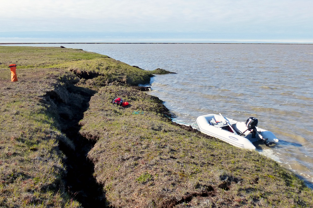
Figure 5: Block failure at Lake L31, North Slope, Alaska (Photo: Ingmar Nitze).

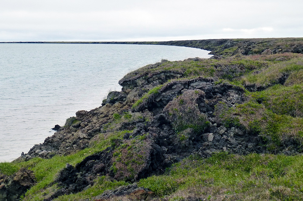
Figure 6: Thaw slumping at Lake Tes-1, North Slope, Alaska (Photo: Ingmar Nitze).
Moving 400 miles (640 kilometers) to the northeast, to the area just north of Teshekpuk Lake near the Arctic Ocean, we find another area where thermokarst lake processes can be seen well. A 2015 photo of the south shore of Lake L31 (Figure 5) clearly shows a large block of soil eroding into the lake. On the eastern shore of Lake Tes-1 (Figure 6), melting ice from the formerly solid permafrost is soaking the ground, eventually leading to sediment transport into the lake.
Zoom in on the locations where the two images were taken:
Switch between change map and satellite images:

In the change map, you can see dark blue edges around the lakeshore - indicating an increase in wetness. You can use the »measure distances« control (see screenshot) to get an idea of how many meters the two lakes have grown over the last 20 years.
Let's look at the area about 30 miles (50 kilometers) south of Teshekpuk Lake. Here we can see on the change map that there has been much less lake growth over the past 20 years. This area is dominated by sandy soils, which contain much less ice than other ice-rich soils. Therefore, the process of lake growth is much less pronounced in this region.
Side note: sand dunes in the Arctic

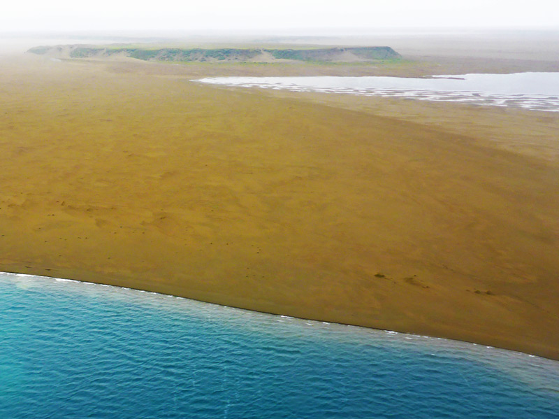
Figure 7: View of the Pik Sand Dunes taken during an AWI flight campaign in July 2015, North Slope, Alaska (Photo: Ingmar Nitze).
Did you notice an area of light blue and orange around four lakes a little further north? If you zoom in here and switch back to the satellite image, you can see dune formations called the Pik Sand Dunes (see Figure 7). For more background on this unlikely tropical resort in the middle of the Arctic, read the article by the National Audubon Society, an American non-profit environmental organization, linked below.
Further reading
Susan C. (2019): A Curious Land Formation in the Western Arctic. Explore the Pik Dunes. National Audubon Society. URL: https://ak.audubon.org/press-release/curious-land-formation-western-arctic
